


Cindy Picos was dropped by her home insurer last month. The reason: aerial photos of her roof, which her insurer refused to let her see.
“I thought they had the wrong house,” said Picos, who lives in northern California. “Our roof is in fine shape.”
Her insurer said its images showed her roof had “lived its life expectancy.” Picos paid for an independent inspection that found the roof had another 10 years of life. Her insurer declined to reconsider its decision.
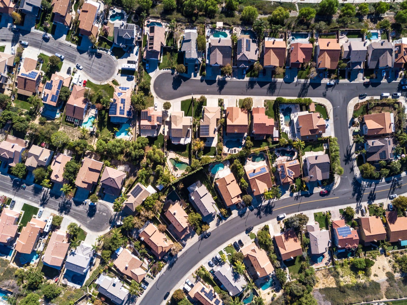
Across the U.S., insurance companies are using aerial images of homes as a tool to ditch properties seen as higher risk.
Nearly every building in the country is being photographed, often without the owner’s knowledge. Companies are deploying drones, manned airplanes and high-altitude balloons to take images of properties. No place is shielded: The industry-funded Geospatial Insurance Consortium has an airplane imagery program it says covers 99% of the U.S. population.
The array of photos is being sorted by computer models to spy out underwriting no-nos, such as damaged roof shingles, yard debris, overhanging tree branches and undeclared swimming pools or trampolines. The red-flagged images are providing insurers with ammunition for nonrenewal notices nationwide.
“We’ve seen a dramatic increase across the country in reports from consumers who’ve been dropped by their insurers on the basis of an aerial image,” said Amy Bach, executive director of consumer group United Policyholders.
The increasingly sophisticated use of flyby photos comes as home insurers nationwide scramble to “derisk” their property portfolios, dropping less-than-perfect homes in an effort to recover from big underwriting losses.
nsurers say that customers agree to home inspections when they buy a policy and that photographing properties from the sky is less intrusive than the home visits used in the past. They say deploying fleets of surveillance planes lets them respond more quickly to disasters and charge rates that better reflect a property’s risk.
“If your roof is 20 years old and one hailstorm is going to take it off, you should pay more than somebody with a brand new roof,” Allstate CEO Tom Wilson said in an interview. He also said that the insurance giant is far along in using digital images to improve underwriting and that “there’s even more to come.”
The industry’s enthusiastic embrace of digital surveillance is sounding alarm bells among consumer advocates. One concern: whether customers can easily challenge images that might be out of date or inaccurate.
Picos, who lives in Auburn, Calif., said it is “absolutely wrong” that she was dropped without being able to see the evidence that precipitated the decision.
A spokesman for her insurer, CSAA Insurance, said it has changed its policy to allow customers to see images on request. Plane and satellite images are reviewed by employees and enable accurate and efficient inspections, the spokesman said.
Others across California are getting nonrenewal notices as well. State Farm last month said it would cull some of its policies in the Golden State; it plans to drop coverage on around 30,000 residential and 42,000 commercial properties. It didn’t specify how it would decide which policies to drop. A spokesman said the financial health of its Californian homeowners operation continues to be affected by factors such as inflation and catastrophe exposure.
Several states restrict the reasons insurers can cite for not renewing home policies after a set time, typically one to five years. One of the few reasons allowed is a customer’s failure to meet underwriting requirements, such as maintaining a house’s roof.
Home inspections purporting to show such problems are making it easier for insurers to drop customers, despite the state protections, said Betsy Clement, a managing director for insurance brokerage Arthur J. Gallagher. She added that her firm has seen an unprecedented level of nonrenewals since the start of 2022.
The images facilitating nonrenewals aren’t always up to date or accurately interpreted by insurers, according to industry insiders and consumer advocates.
Nichole Brink quit her job as an agent for Farmers Insurance last year, concerned the insurance giant appeared to be using aerial images as a battering ram to clear out unwanted customers.
“It’s like they’re using anything as an excuse to get people off their books,” said Brink, who still works in the insurance industry. Farmers appeared to be scrutinizing every property on its books, she said, adding that she saw nonrenewal notices sent for everything from trampolines to moss on the side of a vacation home.
Brink, who worked for Farmers in Michigan, said some customers were dropped based on aerial images that were two or three years old. One person wasn’t renewed because of a roof, despite its being brand new. In another case, a part of the image that Farmers said showed tree limbs turned out to be just shadows, she said.
The final straw came when Brink saw her own home flagged in a Farmers image because of a tree branch overhanging her barn. She switched insurers and jobs.
A spokesman for Farmers said it regularly reviews the properties it insures. When a potential problem is flagged, customers have at least 60 days to correct any inaccuracies or show the issue has been addressed, he said.
Consumer groups say that the use of inspections to drive nonrenewals is worrisome because of the limited rights customers have to challenge the images or complain that the surveillance is an intrusion on their privacy.
“The technology is way ahead of any consumer protections,” said Douglas Heller, director of insurance at the Consumer Federation of America.
Many people would likely object to having their homes and yards watched from above if given a choice, Heller said, citing customers’ relatively slow uptake of discounts for letting auto insurers track their driving.
“Part of the industry strategy is to avoid any situation where consumers get to say ‘yes’ or ‘no’ to this kind of spyware approach to underwriting and rating,” Heller said.
Aerial images are expected to become increasingly detailed and frequent. If satellite launches go as planned, images could be updated daily by 2030, according to Neil Pearson, a consultant who works with imagery companies.
“It could get interesting from a privacy standpoint as…a property could be monitored daily at high resolution,” he said. “It is a bit Orwellian.”