


AM Best Dan Ward, atmospheric scientist and director of model development, Karen Clark and Co., discusses the outlook for the 2024 hurricane season. Ward expects a very active season this year, especially in places such as Florida and Louisiana, as well as wildfire as a secondary peril.
Following is an edited transcript of the interview:
Q: Is there any correlation between global warming and hurricane activity, either from a frequency or severity standpoint or perhaps even both?
A: It’s actually important to separate the severity and frequency when we’re talking about connections between climate change and hurricane activity. The current scientific consensus is that with warming temperatures globally, we are seeing an increase in the intensity of hurricanes. So, we’re seeing more of the intense hurricanes than we would have seen in an otherwise cooler climate.
When it comes to frequency, however, it’s a different story. There’s a lot more uncertainty and less confidence in projections of hurricane frequency in a warming climate. The reason is because there’s a lot of different factors that can contribute to the number of hurricanes that we would see in a warming climate. Severity, on the other hand, is very tightly connected to the warmth of the ocean. We know that the oceans are warming, so we can make that connection. Frequency, a lot more complicated, and so there’s less confidence in any trend increasing or decreasing in frequency.
Q: Is it fair to say we’ve been seeing more storm surge in recent years, and if so, what’s driving that?
A: Yes. In terms of storm surge, here’s where we have a really robust connection to climate change. So, in addition to more intense storms, which can lead to higher peak storm surge in hurricanes, we also have the component of sea level rise. So, sea levels have been observed to be rising with warming temperatures.
There’s two main contributors to this. The one that everybody thinks of, of course, is the melting of the ice cap. So, any ice that’s on land, like in Greenland or Antarctica, as the temperature’s warm, it melts and it just goes directly to contribute to oceans rising. Another less talked about contributor to sea level rise is that as the oceans warm, they actually expand a little bit. Warm water actually takes up a little more space. And so that also contributes to the rising sea levels and the very straightforward connection to storm surge impacts is that the higher your sea level, the higher your storm surge is going to be.
Q: What about secondary perils? What are we seeing there? Are they becoming more frequent? What’s driving that and what impact are they having on the insurance industry?
A: So, with atmospheric perils and the connection to climate change, everyone is different, so they all respond a little bit differently to climate change. And when we model these impacts and we study these atmospheric perils, we do model and study them separately. I can go through a few of them.
One particular secondary peril that’s been on the top of everybody’s mind is wildfires in the U.S., particularly in the Western U.S. Here is a case where we have a very strong connection to climate change, and warming temperatures. As temperatures warm and particularly in arid and semi-arid climates like the Western United States, the atmosphere dries as well as warms and this leads to drying of the vegetation in these areas and you can also read vegetation as fuel for wildfires. So, warmer temperatures, drier fuels and more wildfires and we see this effect in observations, as well as in modeling studies. We do expect more wildfires in the future due to climate change.
Another secondary peril that on an annual basis leads to much more in insured losses than wildfires is severe convective storms, and this impacts the entire country. There’s also been a lot of talk about SCS, as we call it, and its connection to climate change. Here is another case kind of like the hurricane frequency where there’s a lot of different ingredients that go into this and it complicates the picture and leads to much more uncertainty surrounding this particular peril.
To go back to wildfire for a second, we can connect that very tightly to this drying of the atmosphere. It’s a very strong relationship and that gives us much more confidence in that connection. SCS, severe convective storms, they are connected to what we call vertical wind shear in the atmosphere, changes in wind speed and direction with height, but also the stability of the atmosphere. What’s the temperature profile of the atmosphere? What’s the humidity in the atmosphere? All of these different factors can contribute to SCS and they are changing differently in response to climate change. And that creates a very complicated picture where there’s changes in seasonality and the geography of this peril that are highly complicated, still being studied and difficult to model.
There is a lot of work being done on this and there’s a couple of more robust conclusions that have been reached recently. We do think we’re seeing a shift in tornado activity away from the classic tornado alley, the Great Plains, center of the country, Kansas, and Oklahoma in those places, and more toward so-called Dixie Alley, which is more the Southeast U.S., more Louisiana, Alabama, Mississippi. This has to do with changes in the temperature of the Gulf of Mexico and how that impacts all these different factors. So, it’s a complicated picture with SCS.
Q: How are the models evolving as hurricanes themselves seem to be evolving and can the models keep up?
A: The models can keep up. Here at Karen Clark and Co., we make it a very high priority to ensure that our models are keeping up, and there are absolutely ways to do this. We bring in the current science on all of these topics. What we do is we ensure that our models are accounting for any past trends due to climate change. So, for hurricanes, we perform an analysis on global hurricane data and we incorporate this shift toward more intense storms into our model to give an accurate picture of the risk from hurricanes today in today’s warmer climate.
For other perils, like the SCS that we just talked about, it’s so complex that it’s hard to understand the connection to climate change. So, for that particular peril here at KCC, we built what’s called a physics-based model, which incorporates events as they occur. We build this model on events from the recent history so we can be assured that even if scientists don’t really understand what the connections are yet, those connections are built into our model and built into our view of the present day risk. We absolutely think that this is incredibly important to ensure that models are reflective of the present day.
Q: How are insurers reacting to all of this?
A: I think there’s understandably a lot questions about climate change and how this is impacting the insurance market. We do see a lot of catastrophes in recent years. The challenge is to quantify exactly how much climate change is contributing to increases and losses because it’s really just one of a lot of different factors. There’s changes in exposure or changes in construction costs and all these different factors can lead to increases and insured losses.
What I see our role to be as catastrophe modelers coming from the atmospheric side of this is really to quantify that climate change contribution. How much of that increases due to climate change? When we can quantify that and we can bring some knowledge and understanding of what that contribution is that I think that leads to more confidence that insurers can say, “OK, we understand what the trends are and then we can plan for that.” And I think that just brings a little more confidence.
Q: We’ve increasingly been hearing about some insurers pulling out of states like Florida and Louisiana. What could that mean for what is expected to be a very active hurricane season?
A: I think that again this goes back to really understanding the risk and having a having confidence in and that and your understanding of the risk and I think that’s really where the catastrophe models can come in and again, if insurers are using a model that accounts for the impacts of climate change, then I think that they can be more confident about what the risk in any given year is, whether it’s expected to be an active season or not.
Q: What is your outlook for the 2024 hurricane season?
A: It is expected to be an active season. All the seasonal forecasts that have been released today are in agreement that it is expected to be above average in terms of activity. The Colorado State University seasonal forecast actually is expecting the largest number of hurricanes that they’ve ever predicted, with 11 for the season.
This is really because of two main factors. One factor is that the ocean temperatures, the ocean heat content in the Atlantic, particularly in the main development region, which is where we expect most of the major hurricanes to develop during a typical season, the ocean temperatures in that area are historically warm right now. It’s got a lot of people’s attention because where we are right now, we’re in late spring, and the temperatures are about what we expect to see on average in early August, which is actually getting close to the peak of hurricane season. So, the temperatures are already incredibly warm. That’s one factor, hurricanes love that warm water. They need warm water in order to form and intensify. So, that will tend to lead to more active season.
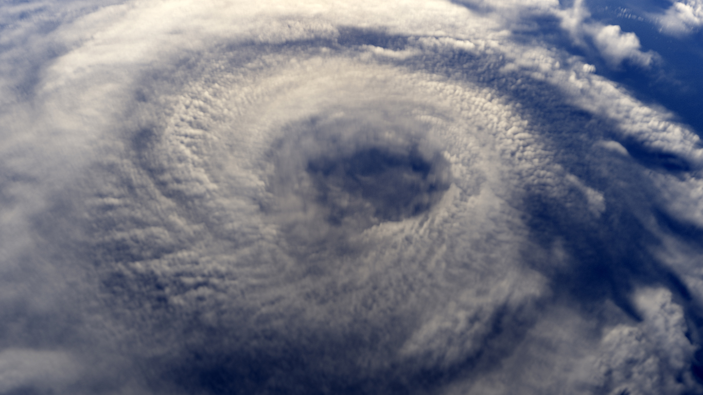
The other main factor is that the projections indicate that we are transitioning into a La Niña, later the summer and into the fall. And La Niña is also I would say good for hurricane formation in the Atlantic Ocean, because it tends to reduce what’s called this vertical wind shear, which can disrupt a hurricane circulation. So the hurricanes, you can picture them in the satellite view, they’re very symmetrical. They want that symmetry and any changes in the large scale winds with height tend to disrupt that symmetry and can reduce hurricane activity. So La Niña beats to a reduction in vertical wind shear, which again would enhance a hurricane activity on average.
So, those are the two main reasons why we expect to see an active season in the Atlantic with regard to hurricanes this year.