


Microsoft and NASA are applying artificial intelligence to hydrology, a field of science that focuses on understanding Earth’s water systems. Their collaboration has resulted in Hydrology Copilot, a suite of AI agents designed to simplify access, analysis, and interpretation of large-scale hydrological data.
Hydrology Copilot builds on the foundation of NASA Earth Copilot, a cloud-based AI platform created to search and analyze petabytes of Earth science data. Together, these tools aim to reduce barriers that have traditionally limited access to complex hydrology datasets.
Making Hydrology Data More Accessible
Hydrology examines the movement and distribution of water across the planet, including precipitation, runoff, evaporation, and the flow of water through rivers, lakes, and soil. While the field plays a role in academic research, it also supports practical decision-making across agriculture, forestry, urban development, and environmental planning.
According to Juan Carlos López, senior solution specialist at Microsoft focusing on space and AI, NASA has long produced advanced hydrology and land-surface datasets. These datasets support drought early-warning systems and environmental research. However, specialized tools and technical expertise often limit who can use them effectively.
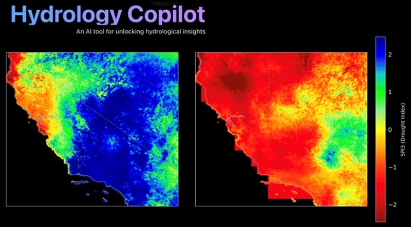
Hydrology Copilot addresses that challenge by allowing users to query NASA data using plain-language questions. For example, users can ask which regions may face elevated flood risk and receive visual, interactive results.
Powered by NASA and Microsoft Platforms
The platform uses Microsoft Azure OpenAI Service and Microsoft Foundry. It also simplifies access to one of NASA’s most advanced hydrology datasets, the North American Land Data Assimilation System Version 3.
This dataset combines satellite observations with computer models to deliver a continuously updated, high-resolution view of the North American water cycle. As a result, it provides continental-scale insight into changing hydrological conditions.
Applications for Planning and Preparedness
Data from Hydrology Copilot can support several planning functions. These include drought monitoring, agricultural planning, water resource management, flood risk assessment, and emergency preparedness.
Microsoft referenced recent flooding in Western Washington, driven by successive atmospheric rivers, as an example of why improved access to hydrological insight matters. The platform enables researchers and planners to gain a deeper understanding of weather-driven water events by utilizing integrated datasets.
A Microsoft spokesperson stated that the project’s goal is to equip local officials, city planners, and emergency responders with tools that help them understand weather patterns and prepare for hydrological events occurring in the Pacific Northwest and globally.
Current Status and Public Resources
Hydrology Copilot is currently under development and is primarily used by researchers. Microsoft’s Azure AI team can provide additional information about the platform.
For those seeking publicly available hydrology data tools, Microsoft pointed to resources such as King County’s Hydrologic Information Center and the interactive map offered by the National Water Prediction Service.
As extreme weather continues to draw attention to water-related risks, Hydrology Copilot represents an effort to improve access to existing scientific data rather than create new forecasts or predictions.
Get the latest insurance market updates and discover exclusive program opportunities at ProgramBusiness.com.