


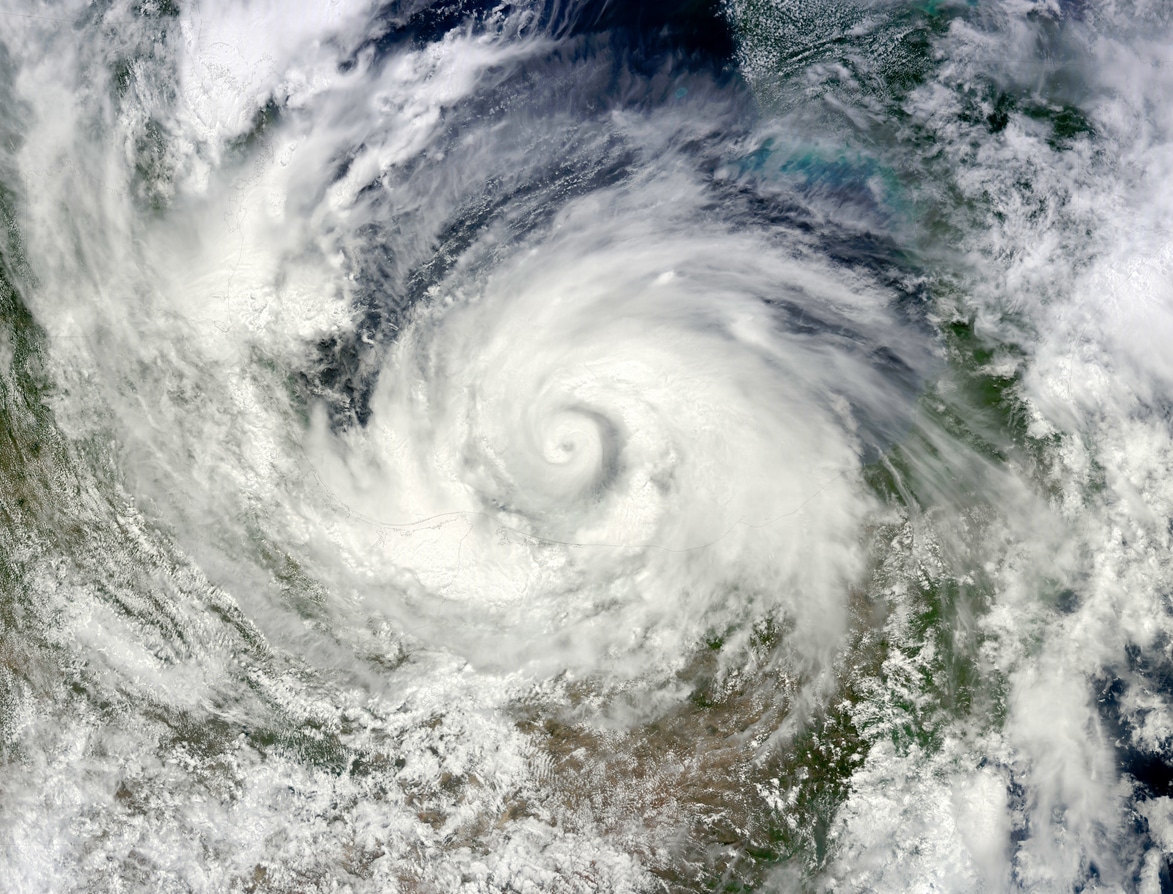
Tropical Cyclone Alfred is set to be a significant weather event for Australia, bringing severe weather conditions over several days. Currently categorized as a Category 2 tropical cyclone, Alfred is expected to impact southern Queensland and northern New South Wales with heavy rainfall, damaging winds, and coastal flooding.
This report provides a detailed day-by-day breakdown of Alfred’s expected movement and potential effects based on current meteorological models.
Thursday: Increasing Rainfall and Wind Intensifies
On Thursday, Cyclone Alfred is projected to remain just off the southern Queensland coast, gradually moving westward.
- Wind and Rainfall: The storm will continue to bring increasing winds and rainfall to the northern New South Wales (NSW) and southern Queensland coastline.
- Wind Speed: Gales exceeding 90 km/h are expected in areas such as Grafton and Double Island Point, while gusts may surpass 125 km/h near the Queensland/NSW border and Brisbane if Alfred remains within 100 km of the coast.
- Flooding Risk: Torrential rain is anticipated, with 24-hour totals potentially exceeding 100mm. Areas south of Alfred’s eye, particularly the Gold Coast, Northern Rivers, and inland Mid North Coast, will be at a heightened risk of flash and river flooding.
- Coastal Conditions: Large offshore swells will persist, with wave heights exceeding 10 meters, causing coastal erosion and inundation, especially during high tide.
Friday: Landfall and Peak Impact
Alfred is expected to make landfall along the far southern Queensland coast by Friday, bringing its strongest winds and heaviest rainfall.
- Wind Speed: Wind gusts could reach up to 150 km/h, posing a risk of roof damage, crop destruction, and fallen trees.
- Flooding Concerns:
- Six-hour rainfall totals may reach 250mm near the Gold Coast and Northern Rivers region, increasing the likelihood of life-threatening flash floods.
- 24-hour totals may exceed 400mm, with major river flooding expected, particularly near the Queensland/NSW border.
- Flood risks will extend to the Mid-North Coast, including areas near the Manning River, where heavy rainfall may lead to significant water level rises.
- Coastal Hazards: The combination of strong winds and high tides will maintain damaging surf, exacerbating coastal erosion and storm surge flooding.
- Inland Impacts: As Alfred moves westward, rain could spread further inland, affecting the NSW Northern Tablelands and Southern Darling Downs, where accumulations may exceed 50mm.
Saturday: Persistent Rainfall as Alfred Moves Inland
As Alfred weakens and transitions into a tropical low, its movement will dictate ongoing impacts.
- Rainfall Projections:
- 100mm+ accumulations are still possible from Brisbane to the NSW Mid-North Coast.
- Local six-hour rainfall totals could exceed 200mm, and 24-hour totals may approach 400mm.
- The Darling Downs and Northern Tablelands could see 48-hour totals exceeding 100mm, exacerbating river flooding in already impacted regions.
- Coastal and Inland Flooding: Floodwaters will remain elevated in many areas, with persistent rainfall prolonging inundation risks.
Sunday: Alfred Weakens, but Rainfall May Continue
By Sunday, Alfred is likely to be a decaying low-pressure system tracking south over inland NSW. However, meteorological models suggest two possible scenarios:
- Accelerated movement southward, bringing widespread rain to NSW and possibly northern Victoria, reducing the risk for southeast Queensland and northeast NSW.
- Stalling over already flooded catchments would prolong heavy rainfall and increase flooding risks in affected regions.
Key Takeaways and Safety Considerations
- Wind Impacts: Wind gusts up to 150 km/h could cause structural damage and widespread power outages.
- Flooding Risks: With potential totals nearing 1000mm in some areas, flash flooding and river flooding will be major concerns.
- Coastal Damage: High tides, storm surges, and large waves will continue to erode beaches and cause coastal flooding.
Residents in affected areas should monitor official weather updates, take precautionary measures, and follow guidance from emergency services. Cyclone Alfred remains a dynamic and evolving situation, and its ultimate impact will depend on its trajectory and speed as it approaches land.